|
|
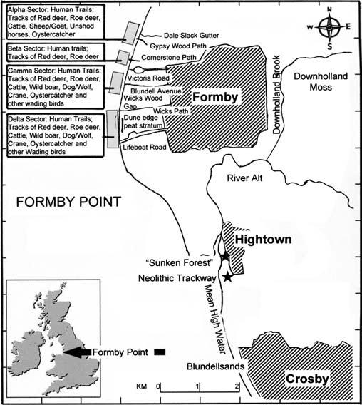
The coastal township of Formby is situated in Northwest England, between Southport
and Liverpool. A belt of pinewoods and sand dunes lies between it and the sea. The Formby Footprints are located along a 4km stretch of the coast between Lifeboat Road and Gypsy Wood (OS Grid
Refs SD 268 063 and SD 275 094). They may be found in discontinuous outcrops of silt which appear from time to time
on the foreshore, roughly 50 to 100 metres west of the dune edge. Park at either the Formby Point National Trust Victoria
Road car park (SD 281 082), or on the Metropolitan Borough of Sefton's property at Lifeboat Road (SD 275 065). (I
should also add that a few imprints were discovered recently at Ainsdale Beach, near Shore Road. They were observed
in gale-exposed, desultory patches of mud - vestiges of the prehistoric, fringing salt marsh which once lay between the Formby
Point and the Ribble Estuary.)
Guided walks take place throughout the year and are organised by the National Trust and the Sefton Coast Landscape Partnership, through which Liverpool Museum frequently offers professionally-led Archaeology Taster Sessions as part of its 'Archaeology
Volunteers' programme. |
|

|
As the prints appear randomly along the coastline and may be destroyed by
the following tide, you might need to visit a few times before you find any. They are also under water for two hours either
side of high tide - please remember the tide rises quickly at Formby, so keep an eye on the sea level and make sure you have
a path back to the high water mark. Check tide times here.
|

